 Your Personal Lindal Representative
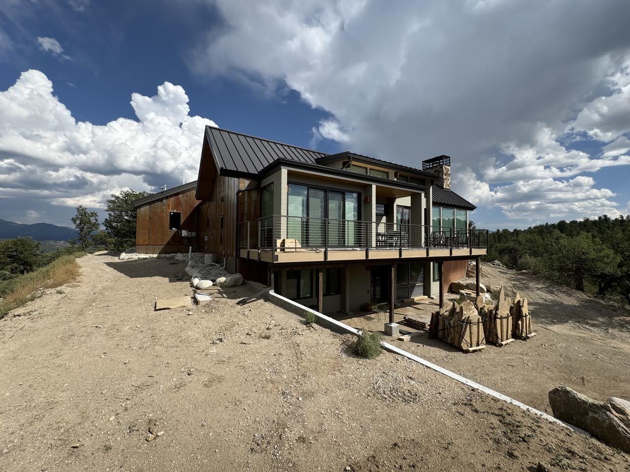
On a working ranch, the house is part of a larger system. It affects access, water, fences, equipment movement, daily chores, and the land’s ability to keep doing its job. The best homesite is rarely chosen by the view alone. It is the place where ranch operations, the practical building area, weather exposure, and the way you want to live can work together.
That is why the site should lead the plan. A favorite floor plan can be a helpful starting point, but it becomes more useful after the ranch’s access routes, water situation, soils, hazards, and operating patterns are understood. The owner’s early job is to identify the questions that could change the project before a homesite or design direction becomes difficult to move.
Start With What the Ranch Needs to Do
Before comparing floor plans, map the daily and seasonal movement across the property. Where does the pickup enter at first light? Which gates are used most often? Where do feed deliveries, a farrier, a veterinarian, contractors, or guests turn around? How do livestock, hay equipment, trailers, and snow removal move through the headquarters area?
Those routes make a stronger first filter than a distant view. A house that blocks the only practical equipment path, forces every delivery through the family yard, or sits too far from the work it needs to support may create a small problem every day for years. At the same time, the home area needs enough separation from dust, noise, flies, livestock traffic, and the parts of the operation that should not spill into daily living.
Write down what the land does now and what it may need to do later. Grazing, hay, horses, hunting, conservation work, a shop, guest use, or a manager’s access each change the homesite conversation. The goal is not to make the house invisible. It is to give it a clear role in the working landscape.
Choose a Homesite by Comparing Tradeoffs
No single spot will usually win every category. A site with a wide view may require a longer driveway, more exposed utilities, a harder winter approach, or more complicated drainage. A quieter mid-slope location nearer existing access may offer less drama but reduce several persistent project burdens. A site-feasibility conversation can help organize the questions to take to the appropriate authorities and local specialists.
Access, arrival, and distance
Every added foot from the public road can affect driveway construction, maintenance, snow management, utility routing, and emergency access. Look at the route in the conditions that matter on your property: mud season, snow, rain, darkness, a loaded trailer, and a delivery vehicle that needs room to turn. Confirm roadway, driveway, culvert, turnaround, and emergency-access requirements with the applicable local authority rather than relying on a general rule.
Access is also a design question. The driveway approach influences where the garage, mudroom, covered entry, equipment zone, and service access belong. A home that faces the direction people actually arrive from can feel simpler to use every day. Majestic Peaks’ mountain-home site checklist provides a related way to organize access, slope, exposure, and local fact-finding on more demanding terrain.
Sun, wind, drainage, and the ground under the home
Orientation matters for the house, but it also affects outdoor work areas, porch comfort, snow drifting, and the relationship between the home and corrals or barns. Notice where the winter sun reaches, where wind carries dust or snow, and where water or cold air collects. A low spot or a striking ridge may still be workable, but it deserves closer technical and cost review before it becomes the assumed answer.
The USDA Natural Resources Conservation Service Web Soil Survey can help with an early screen of mapped soil information. It is a screening tool only, not a survey, a geotechnical report, or an approval for a foundation or wastewater system. Even a favorable map cannot confirm seasonal groundwater, expansive soil behavior, or site-specific bearing conditions. Use it to frame questions, then reserve formal soil, grading, foundation, and wastewater conclusions for the qualified local professionals and authorities responsible for the parcel.
Water, Wastewater, and Soils Can Set the Practical Building Area
On ranch property, water questions should be resolved before the home is placed on a drawing. In Colorado, a well permit identifies the well’s allowable uses, while water rights are administered under the state’s prior-appropriation system. They are related questions, not interchangeable ones. A permit alone does not answer whether the proposed home, livestock, or irrigation use is supported on that parcel. Review the actual permit file through the Colorado Division of Water Resources well-permitting resources, then examine applicable water-right records with the right local water and legal advisors.
For a ranch parcel, ask what source serves the home, what water is available for livestock or irrigation, what uses the permit allows, and whether any decrees, shares, easements, augmentation plans, or basin-specific rules affect the property. The answer varies sharply by parcel and basin. The state’s water-rights guidance explains the prior-appropriation framework; it does not replace a parcel-specific review.
Wastewater planning needs the same discipline. In Colorado, onsite wastewater systems with flows of 2,000 gallons per day or less are permitted by local counties under local requirements. The Colorado Department of Public Health and Environment’s OWTS guidance is a useful starting point, but the local site-and-soil evaluation determines what is required for the property. Leave enough flexibility around a candidate homesite for the locally required system layout and related setbacks before treating the house location as final.
For domestic wells, testing and maintenance are typically owner responsibilities. The EPA’s private-well resources explain the distinction between private-well ownership and public-water regulation. A nearby well or a promising soil map is information to investigate, not a guarantee that the chosen homesite has everything it needs.
Check Hazards and Land Documents Before the Dozer Arrives
Flood and wildfire
Flood exposure, wildfire, easements, conservation restrictions, and grazing arrangements should be visible before the site is graded. The FEMA Flood Map Service Center is the official public source for flood-hazard mapping and is a useful first screen by address or coordinates. Use the current map to begin due diligence, then ask the local floodplain administrator what it means for the proposed location, drainage, and approvals.
Wildfire planning also begins with the site, not just the building materials. The Colorado State Forest Service home-ignition-zone checklists address the home and nearby vegetation, along with ongoing maintenance. For ranch property, include the driveway, access signage, defensible-space work, water supply, and local fire-authority expectations in the early conversation. The relevant fire authority and jurisdiction, not a general checklist, determine the requirements for a specific project.
Recorded documents and operating agreements
Read recorded documents with the same care. A conservation easement may limit the building envelope or site work. A grazing lease may reserve access, water points, or facilities. Easements can shape the route of a driveway or utility line. These are document and location questions for the holder, attorney, surveyor, and local professionals who can interpret the property record. Resolve them before equipment is mobilized.
Agricultural Classification Is a Use Question, Not a Building Shortcut
In Colorado, agricultural classification is a property-tax classification tied to statutory criteria and actual use. It is not a blanket building right, and a new residence does not automatically turn an entire ranch residential. The Colorado Division of Property Taxation’s guidance explains that land beneath a residence may remain agricultural in certain operating circumstances, while up to two acres associated with a residence that is not integral to the agricultural operation may be classified as residential land.
The useful planning question is not, “How many acres will I lose?” It is, “How will the county assessor treat the proposed residence, its associated land, and the working acreage that remains?” Ask the county assessor before selecting the final homesite. The assessor’s parcel-specific determination, supported by the actual operation and records, matters more than a statewide rule of thumb and may change if the property’s use changes. This is planning information, not tax or legal advice.
Design the House for the Way Ranch Life Arrives at the Door
Once the site questions are visible, the design conversation can become more specific. On working land, the entry sequence often deserves more attention than a formal front elevation. Consider where people arrive after chores, what needs to be stored or cleaned up, how a dog or wet gear moves through the home, and whether a covered transition between vehicle and door would improve daily life. A durable mudroom, useful storage, and a direct relationship to the garage, shop, or barn can be more valuable than an ornamental entry that serves a path no one actually takes.
The same thinking applies to the overall arrangement of the home, shop, barn, and equipment shed. There is no single right pattern. A compact grouping may support daily chores and shared utilities; a more separated arrangement may protect quiet living or keep traffic out of the home area. What matters is that the relationship is intentional and based on the operational map, site conditions, and the way you expect to use the property.
Majestic Peaks is an independent Lindal representative. An established plan, a modified plan, or a more custom direction can all be reasonable starting points when evaluated against the ranch’s realities. The guide to designing a home for your land and the custom-home design-path guide explain how a property can inform that choice before a reference plan is treated as final.
Build the Budget Around Distance and Unknowns
On rural land, distance often changes the project more than a finish selection does. The driveway between the road and house, power route, water line, wastewater system, construction access, and site grading all need a place in the early budget conversation. A closer homesite may reduce some of those questions; a more remote one may be the right choice for privacy or operations, but it should be scoped early and estimated rather than assumed.
A useful preliminary budget separates what is known from what still needs investigation. It can name categories such as design work, site work, utilities, the home package, permits, local labor, and finishes without pretending to be a final project price. Majestic Peaks’ financial-feasibility planning can help make scope, priorities, assumptions, and the next pricing inputs visible before a figure is treated as a commitment.
Put Each Question With the Person Who Can Answer It
| Question area | Who formally answers it | Why it affects the homesite |
|---|---|---|
| Agricultural classification and property valuation | County assessor | The proposed residence, associated land, and working acreage may be treated differently based on the parcel’s facts and use. |
| Well permits, water-right records, and water administration | State water authority (primary); water attorney as needed when rights, decrees, shares, or easements require legal review | Allowed uses, water records, and source arrangements can influence where the house and related infrastructure belong. |
| Onsite wastewater evaluation and permit | Local public-health agency and qualified onsite-wastewater professionals | Soils, setbacks, topography, and the required system area can limit the practical building area. |
| Boundaries, easements, and setbacks | Surveyor, title or legal professionals as appropriate, and the applicable jurisdiction | Recorded restrictions and property geometry can determine where the house, driveway, and utilities may go. |
| Foundation, slope, drainage, and site-work conclusions | Qualified civil, geotechnical, structural, and drainage professionals as the project requires | Surface slope and subsurface conditions can affect home placement, access, site-work scope, and construction approach. |
| Power and utility service | Utility provider or electric cooperative | Service location, capacity, extension route, and responsibility can change the infrastructure plan. |
| Project planning, design path, and coordination scope | Owner, Majestic Peaks (within the written project scope), Lindal, and the project team under the written project agreements | Clear roles help separate planning and coordination assistance from formal technical, construction, and approval responsibilities. |
Majestic Peaks can help organize planning questions and coordination with local professionals within the written project scope; it does not issue permits or certify technical conclusions. Formal technical conclusions, construction obligations, and permits remain with the appropriate qualified professionals, contractors, and authorities. The Lindal project-roles guide and coordination and permits service page explain those boundaries in more detail.
Work in a Decision Sequence, Not a Generic Calendar
- Map the ranch as it operates now. Record the work routes, access points, water features, livestock areas, equipment movement, and future uses that should shape the home area.
- Compare candidate homesites. Weigh access, distance, water, soils, weather exposure, hazards, and daily living together rather than choosing by one factor.
- Verify the questions that control the site. Bring the right records and candidate locations to the assessor, water authority, local health agency, utility provider, surveyor, and other qualified professionals.
- Set the early scope before locking the plan. Use what is known and unknown to frame the budget, design path, local project team, and appropriate next investigations.
- Advance design, approvals, and construction in the local path. Jurisdiction, season, site conditions, and written project roles determine timing; no ranch project follows a universal schedule.
Bring the Land to the First Planning Conversation
Bring what you have, rather than waiting for a perfect file. A parcel location, survey or plat, photographs, known well or water records, access notes, easements, leases, the operational map, and the project decision that feels hardest to frame can all make an early conversation more productive.
If you are evaluating ranch property or need to turn a working landscape into a clearer home-planning brief, start a planning conversation with Majestic Peaks. For related land, design, budget, and role questions, the planning library provides additional guides. Majestic Peaks can help identify the next questions; the parcel-specific answers still belong to the professionals and authorities responsible for them.